|

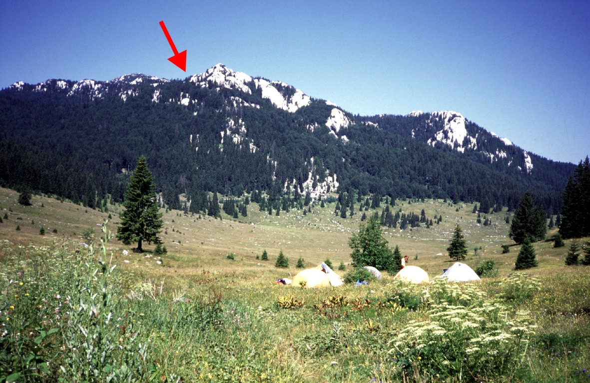
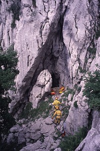
View at Mali kuk (arrow marks the entrance of
Slovačka jama). Photo: D. Bakšić
Speleological exploration of Slovačka jama
Darko Bakšić, Branko Jalžić, Branislav
Šmida,
Damir Lacković, Dalibor Paar
Research
Chronology
During the field
survey, on July 28th 1995, two Slovak cavers, B. Šmida and M. Griflik,
found entrance into Slovačka jama (Slovak Pit). After the exhausting
research that lasted nine days, the Slovak cavers managed to descend 516
m (1692 feet) deep. During the research a horizontal channel was spotted
at -350 m (1148 feet) but due to the lack of time it was postponed for
the next year.

The entrance to Slovačka jama. Photo: Dalibor Paar
In the course of
the summer 1996, the Slovak cavers, with the fellow cavers from the
University Mountaineering Association "Velebit", continued the
exploration of Slovačka jama in the horizontal channel, 350 m deep.
Three weeks later, the cavers descended 1000 m (3280 feet) deep.
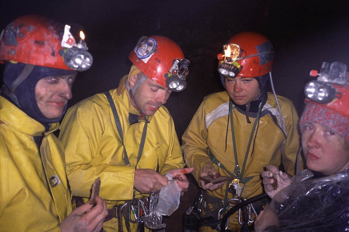
Croatobranchus mestrovi - endemic leech was found in Slovačka jama. In
August 1996, a group of cave explorers from Zagreb Speleological
sections “Velebit” and “Željezničar” in cooperation with the Croatian
Natural History Museum descended 570 m into the pit for the purpose of
gathering the specimens of leeches for the scientific research. Although
the leeches were not found at this time, the remains of new type of
coleopter were found.
SPELEOLOGICAL EXPEDITION SLOVAČKA JAMA 1998.
In order to
continue the exploration of the pit, in the period from July 25th till
August 15th 1998, a joint Croatian-Slovak expedition “Slovačka jama ‘98”
was assembled under the leadership of Darko Bakšić and Branislav Šmida.
30 Croatian and 15 Slovak cavers participated in the expedition. The
main objective was the continuation of the exploration of Slovačka jama
in two separate channels. The Slovak cavers continued with the
exploration in the hall “Pompeii” at depth of 1000 m, while the
“Kankulovski channel” at -587 m (the continuation of this channel is
called “Velebni channel”) was explored by the cavers from “Velebit”.
Members from several other speleological associations also participated
in the exploration and those are the following: SO HPD Željezničar from
Zagreb, SO HPD Japetić from Samobor, SD Had from Poreč and SO HPD
Dubovac from Karlovac.
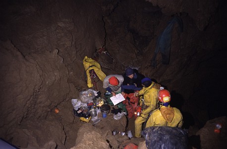
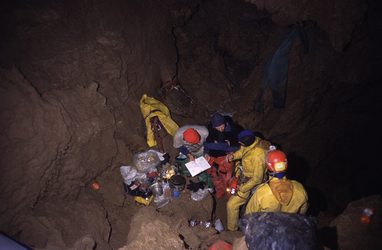
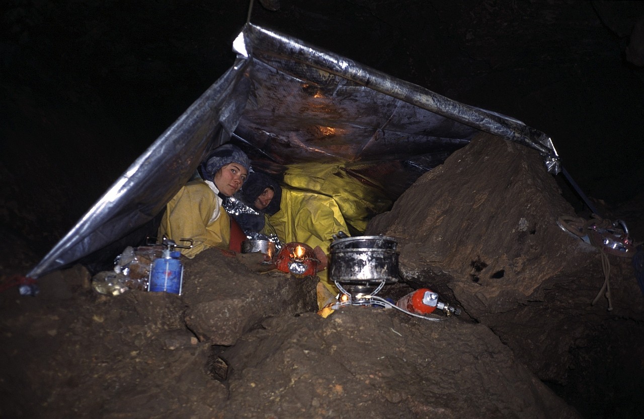
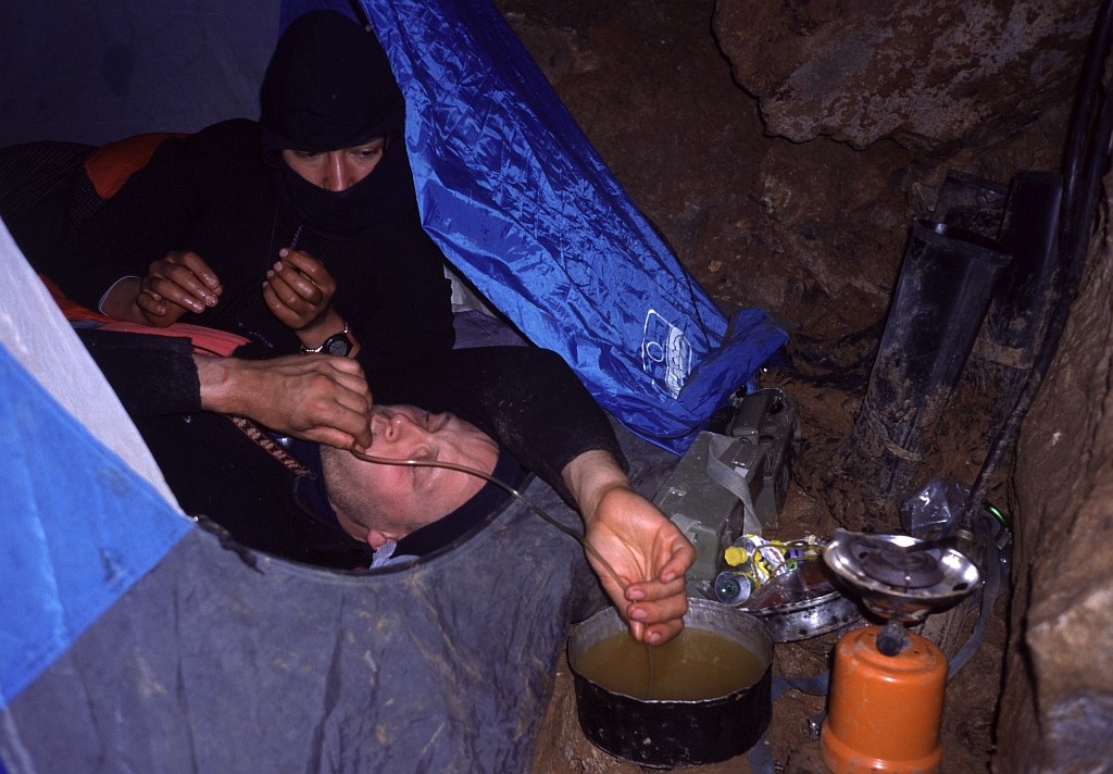
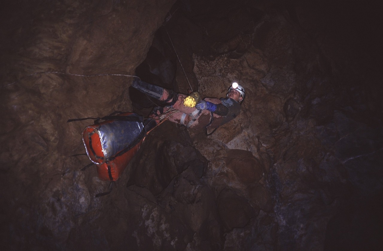
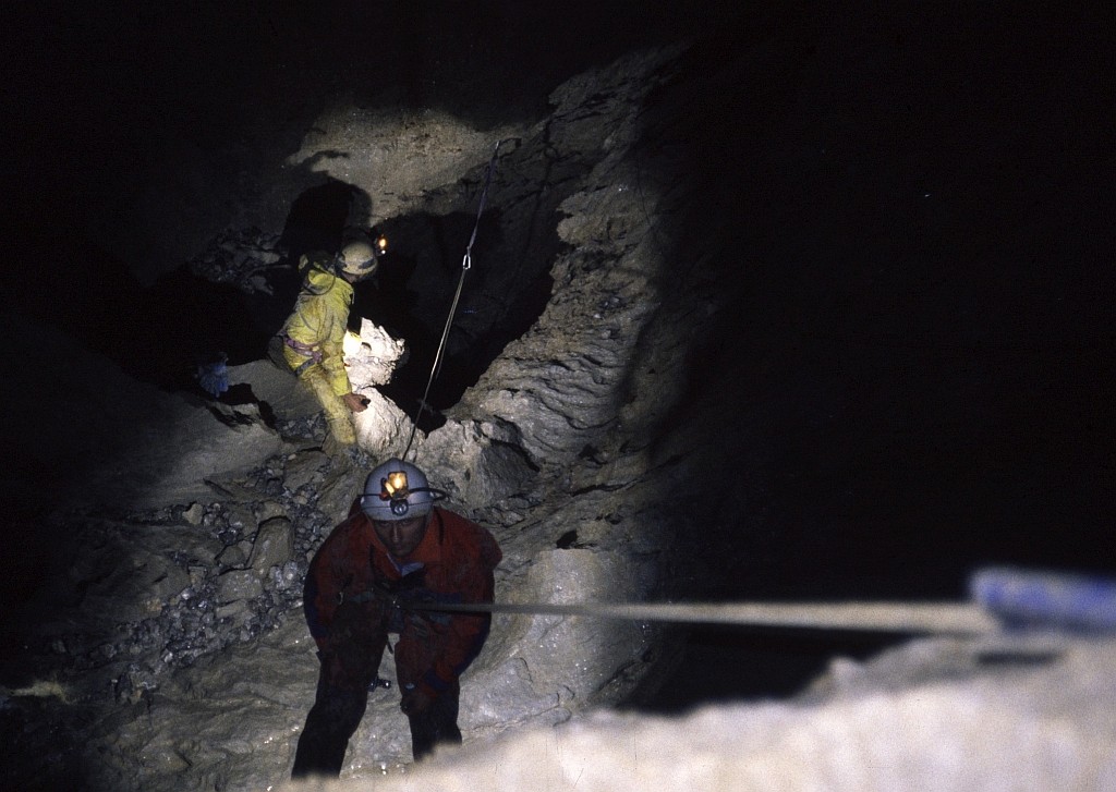
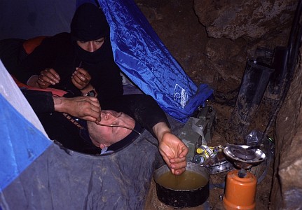
Bivouac II at the depth of -1225 m. Photo: Dalibor Paar
SPELEOLOGICAL EXPEDITION SLOVAČKA JAMA 1999.
In 1999, Slovačka
jama was explored during the weekends, from 16th – 18th of July and in
the duration period of Croatian-Slovak speleological expedition
“Slovačka jama 99” from July 24th till August 8th. Expedition’s base
camp (unlike the previous years) was situated on the north-west edge of
Veliki Lubenovac at the foot of Mali kuk. Main reasons for the
relocation of the camp were shorter approach to the pit which relieved
the transportation of equipment and setting up of telephone wire and the
isolation of the explorers from the numerous visitors of Veliki
Lubenovac during the summer months. During the expedition 28 cavers
altogether entered the pit, 21 of them from SO Velebit along with 3
cavers from SO Željezničar and one from SK Had, SO Dubovac and SO
Malačka. Apart from 17 Slovak cavers, two cavers from Slovenia also
participated in the action. At the very beginning of the expedition a
large amount of rain fell creating numerous reservoirs and small
waterfalls which obstructed and slowed down the exploration. During the
expedition, two bivouacs were set in the pit one 376 m deep and the
other 1254 m (4114 feet), which is the deepest bivouac in Croatia so
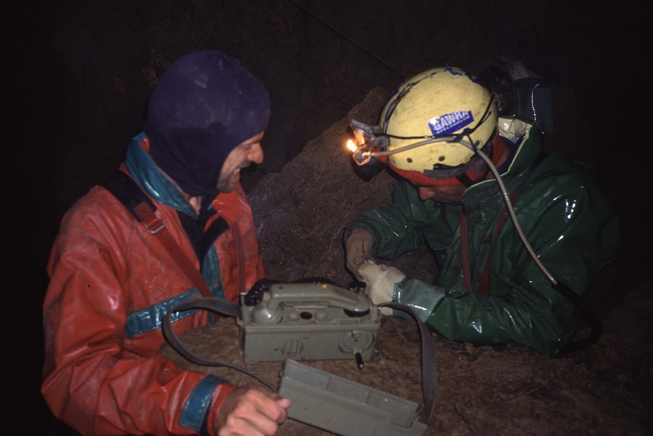
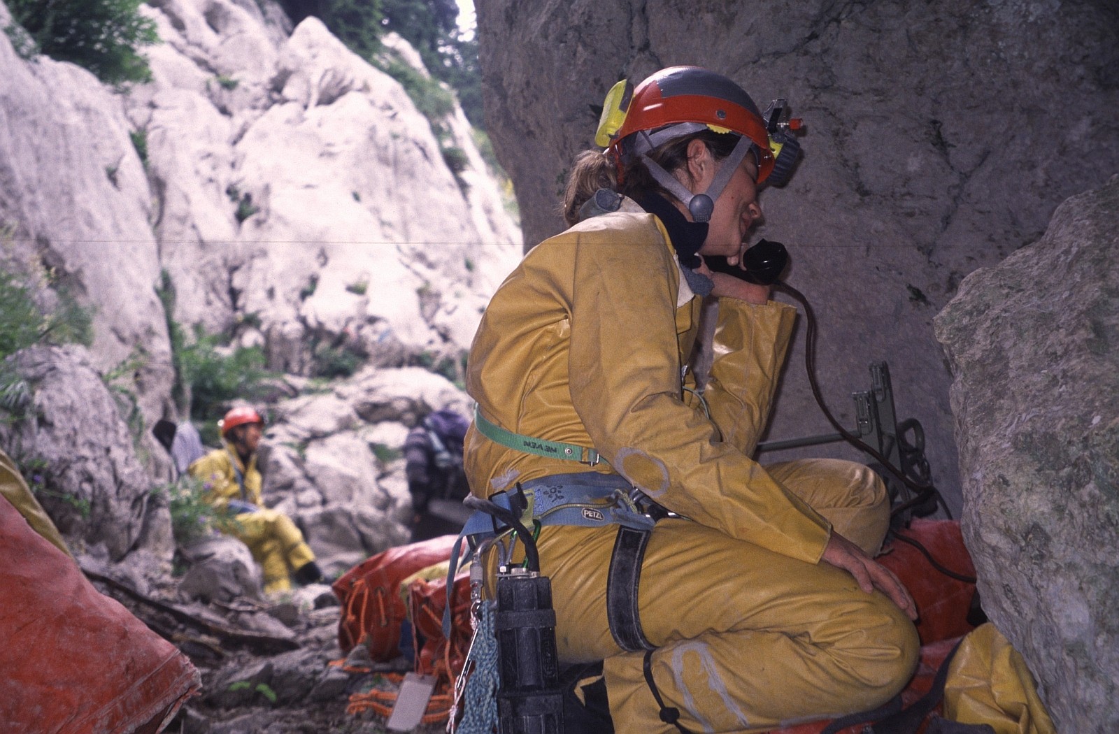
far. Telephone connection was installed from the upper bivouac to the
deeper one which enabled the timely informing on the weather conditions
on surface, needs for materials and food and the progress of the
underground exploration. In order to avoid unnecessary entering and
going out from the pit it was decided to form two teams made of three
members working in 12-hour shifts – one team would sleep in the bivouac
and the other would explore new channels. South-east channel was
explored reaching the siphon on -1301 m (-4268 feet). In the western
part of the hall at the depth of 1225 m (4019 feet) the cavers entered
the channel, later called “Hrskavi” and from there passed through a
narrowing into “Limbo channel” and lowered themselves to unpassable
narrowing on -1286 m (-4219 feet) in meander Oštrica.
In the same year, the Slovak cavers setup two bivouacs on -360 m (-1181
feet) and -665 m (-2181 feet) and continued the exploration in
“Hermanova studna”, which they deepened to -530 m (-1738 feet), (where
they came across an unpassable narrowing), and in “Žumpa channel” where
they descended to -866 m (-2841 feet) in “Novodubnicka studnja” channel
and to a branch on -850 m in the branch “Ta-ta”. Further exploration was
cancelled because the time envisaged for the duration of the expedition
expired (Bakšić 2001).
Biospeleologist
prof. Dr. Boris Sket from Ljubljana University (Slovenia) took a part in
expedition to collect specimen of endemic leech (Croatobranchus
mestrovi) for DNA analysis.

(left)
Pokojna shaft (P50). Photo: V. Božić
(right)
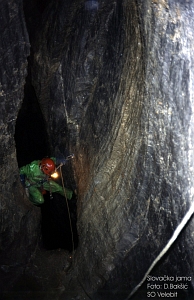
In meander at -560 m. Photo: D. Bakšić
SPELEOLOGICAL EXPEDITION SLOVAČKA JAMA 2002.
Speleological
section of University Mountaineering Club "Velebit" organised the fifth
expedition in Slovačka jama, in the period from July 27th till August
11th 2002. This expedition was performed with the support of Sjeverni
Velebit National Park and the Speleological Committee of the Croatian
Mountaineering Association. 21 caver from SO PDS Velebit, one from SO
HPD Željezničar, two from SO HPD Mosor, five Polish and one Belgian
caver participated in the exploration of Slovačka jama. Approximately 20
more cavers secured the logistical support at the surface. Expedition
was lead by Darko Bakšić. Semi submerged channel 105 m long at the end
of the pit was explored.

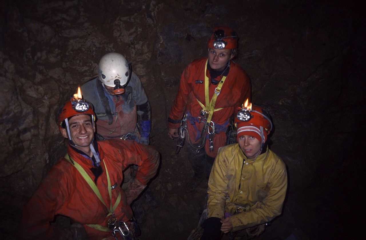
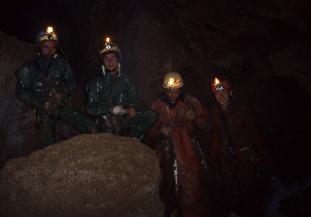
On the Bivouac II in the moments of rest.
Photo: Marija Mačešić
The depth of the
pit was increased for 19 m and now amounts to 1320 m which places
Slovačka jama at 18th place in the world. The channel ended with a
siphon which made any further exploration with the use of classic
speleological techniques impossible. In order to achieve this very
demanding exploration in the pit regarding the logistics and speleology,
two underground camps were built 350 m and 1225 m deep. Two teams
interchanged in equipping the pit with ropes, exploration and
dismantling. Total amount of working hours done in the pit was 1547 of
man-hours. Extremely bad weather conditions (large amount of rain) made
the work and this expedition very hard and also one of the most
demanding and most dangerous expeditions so far (Bakšić 2002).

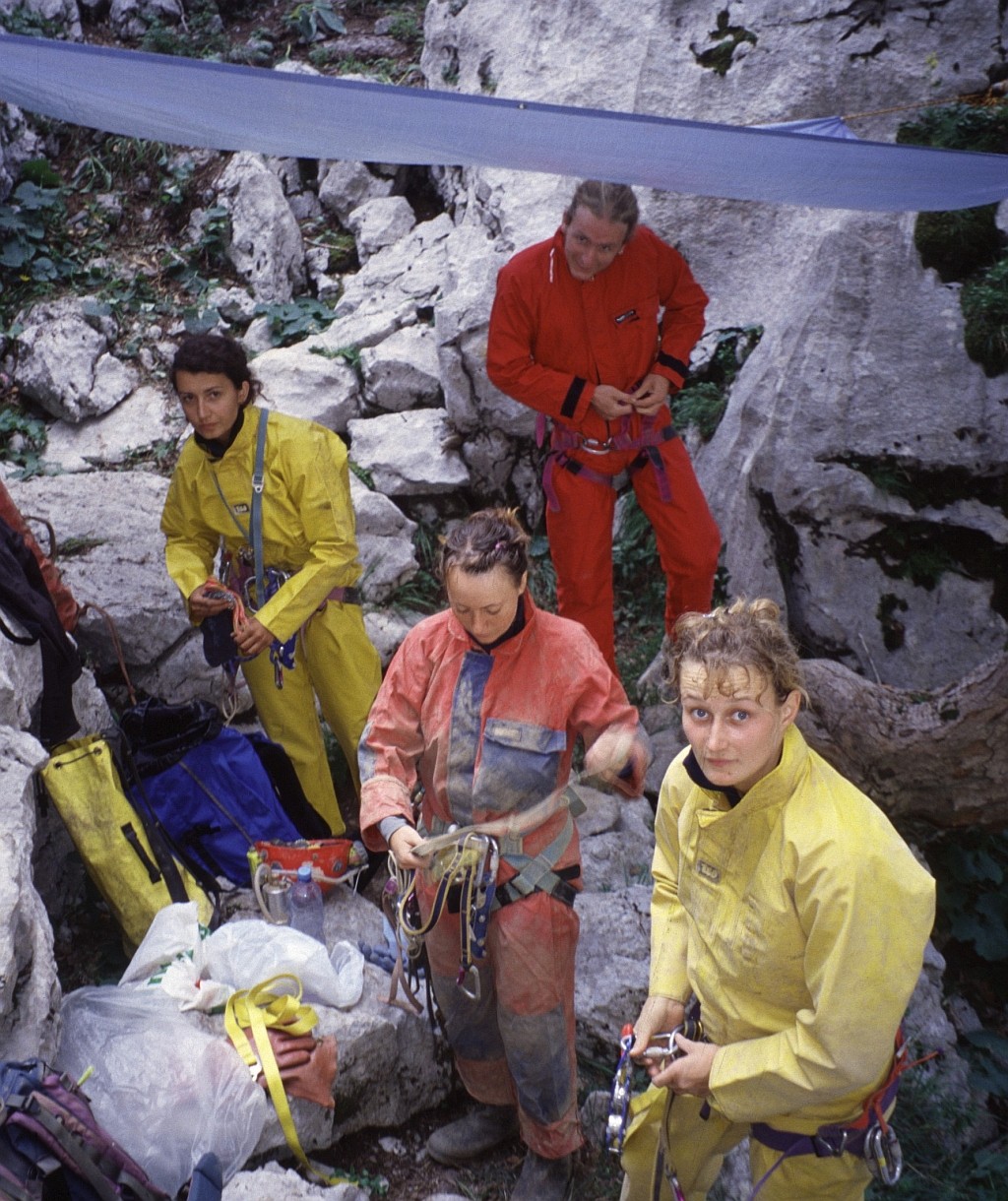
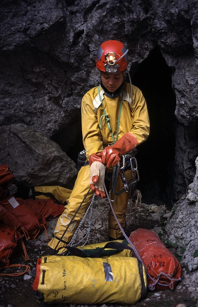
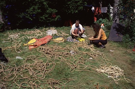
Preparations before entering Slovačka jama.
Photo: D. Bratušek
Literature
Bahun, S. 1974:
The tectogenesis of Mt. Velebit and the formation of Jelar deposits.
Geološki vjesnik 27, Zagreb : 35-51.
Bakšić, D., Paar,
D., 2006: Croatia and the Deep Caves of Northern Velebit. Alpine Karst,
vol 2., ed. J. & T. Oliphant, 105-124, Cave books, Dayton, USA.
Cigna, A.A., 2002:
Modern trend in Cave monitoring. Acta carsologica 31/1, 35-54,
Ljubljana.
Herak, M. & Bahun,
S. (1979):
Hill, C. & Forti,
P. (1997): Cave minerals of the World
Jalžić, B.,
Lacković, D. & Šmida, B. (1995): Lomska Duliba 93; Speleolog
Kuhta, M., Bakšić,
D., 2001: Karstification Dynamics and Development of the Deep Caves on
the North Velebit Mt. – Croatia. 13th Internatinal Congress of
Speleology, 1-4, Brazil.
Lacković, D.,
Šmida, B., Horvatinčić, N., Tibljaš, D., 1999: Some geological
observations in Slovačka jama cave (-1268 m) in Velebit mountain,
Croatia. Acta carsologica 28/2, 113-120, Ljubljana.
Lacković, D.
(1993): Lukina jama u sjevernom Velebitu - najdublja jama Hrvatske;
Vijesti Hrvatskog geološkog društva.
Please cite this article as:
Darko Bakšić, Branko Jalžić, Branislav
Šmida, Damir Lacković, Dalibor Paar: The explorations of Slovačka jama on Northern
Velebit, Croatia. Croatian speleological server,
public.carnet.hr/speleo, 2008.
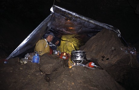
Improvised bivouac at -1200 m. Photo:
Darko Bakšić

Preparation of phone line between Bivouac
II and the surface. Photo:
Dalibor Paar
Lunch at Bivouac II. Photo: Marija Mačešić
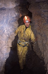
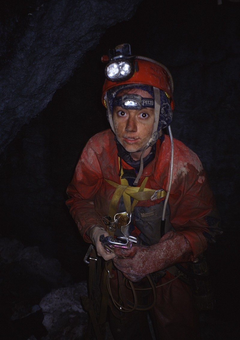
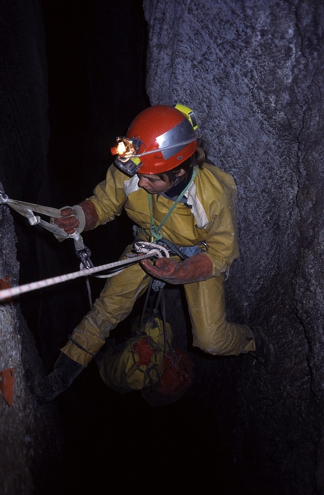
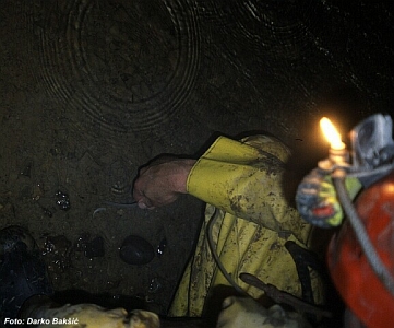
Photo:
D.Bakšić
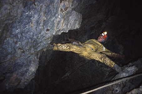
Photo:
D.Bakšić
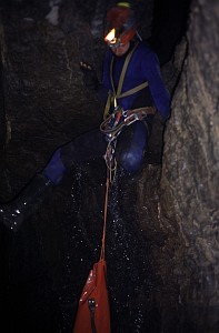
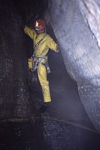
Photo:
D.Bakšić
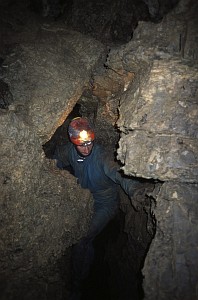

Photo:
D.Bakšić
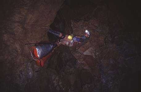
Photo:
D.Bakšić

Photo:
D.Bakšić
Photo:
D.Bakšić
Photo:
D.Bakšić
Photo: D. Paar
Photo: D. Troha
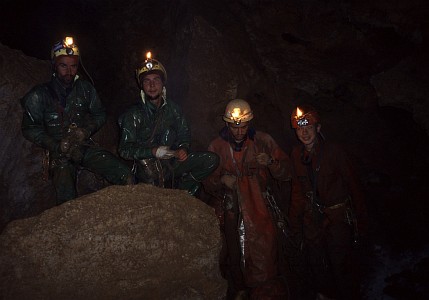
Photo:
D.Bakšić

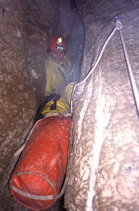
Photo: Marija Mačešić
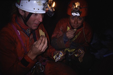
Photo: Ana Katarina Sansević
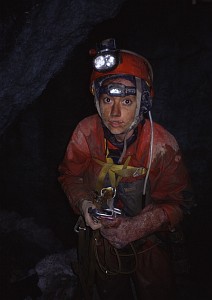 
Photo: Ana Katarina Sansević i D.
Bakšić

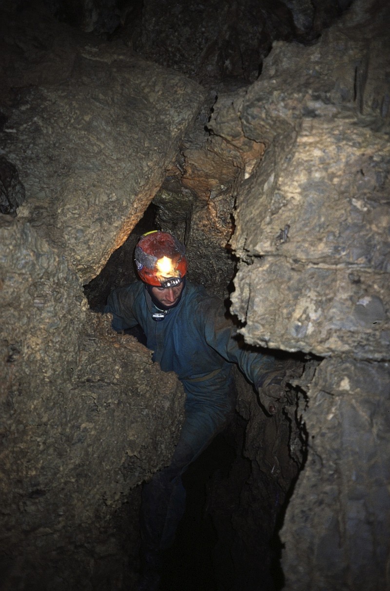
The entrance. Photo: D.Paar
Return from the pit. Photo:
Dalibor Paar
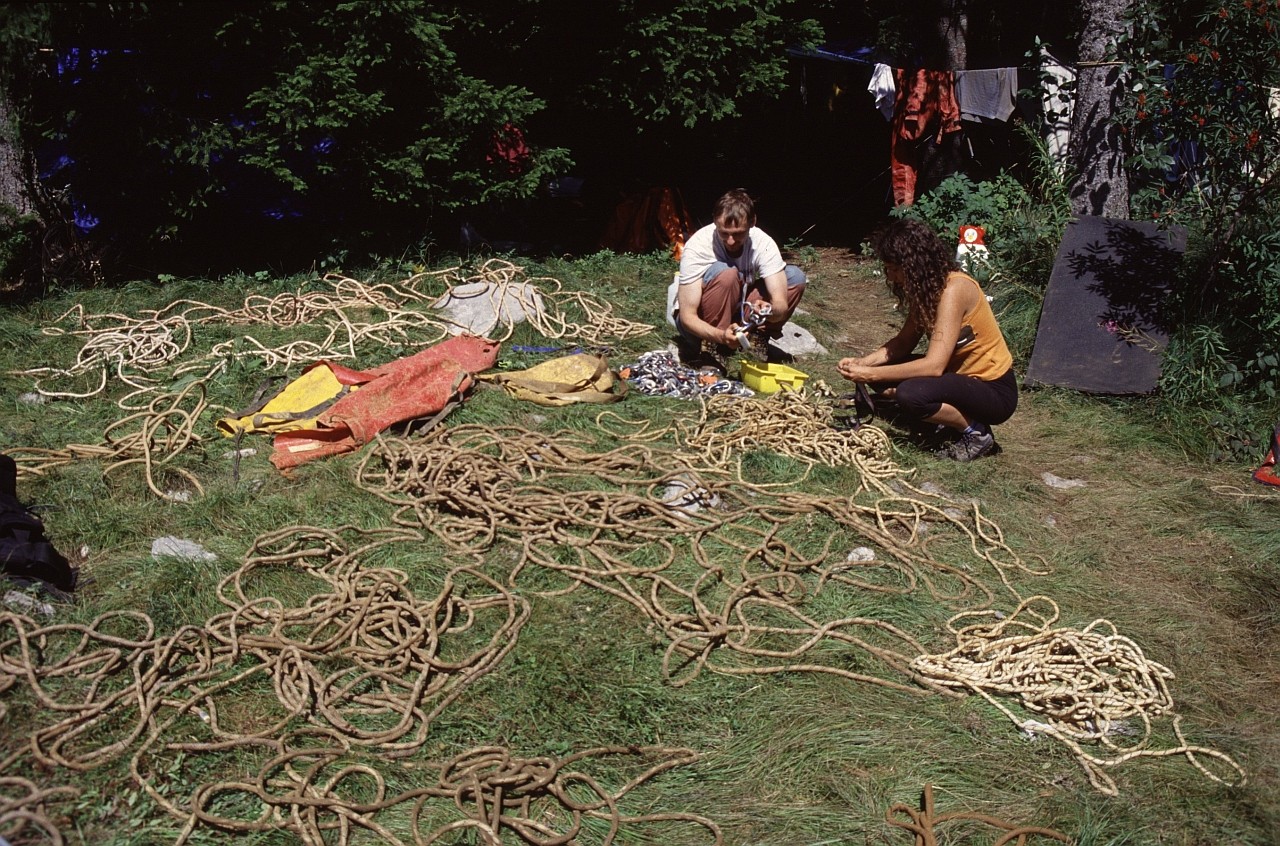
Cleaning after expedition. Photo: Dean Bratušek
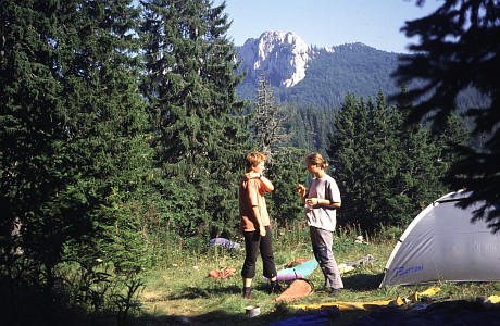
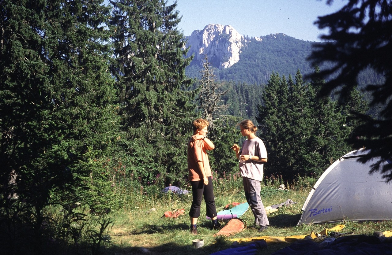
In the camp at Veliki Lubenovac.
Photo:
Dalibor Paar
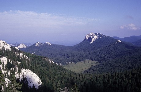
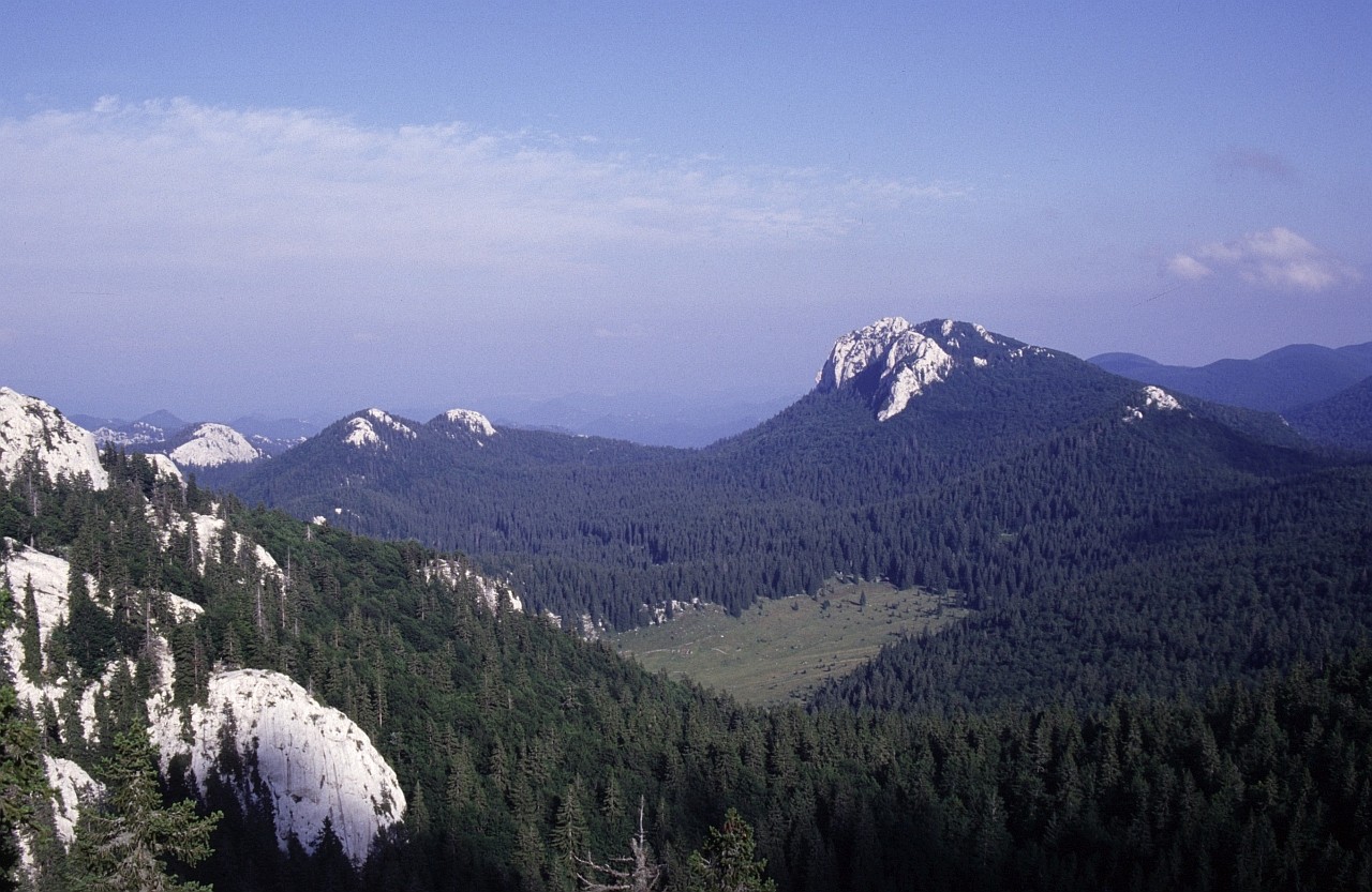
The view from Mali kuk towards V. Lubenovac. Photo: Dean Bratušek
|
|
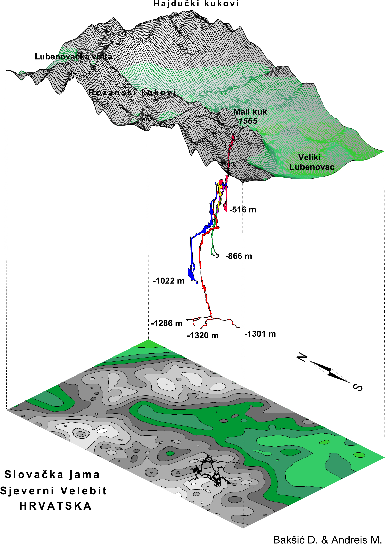
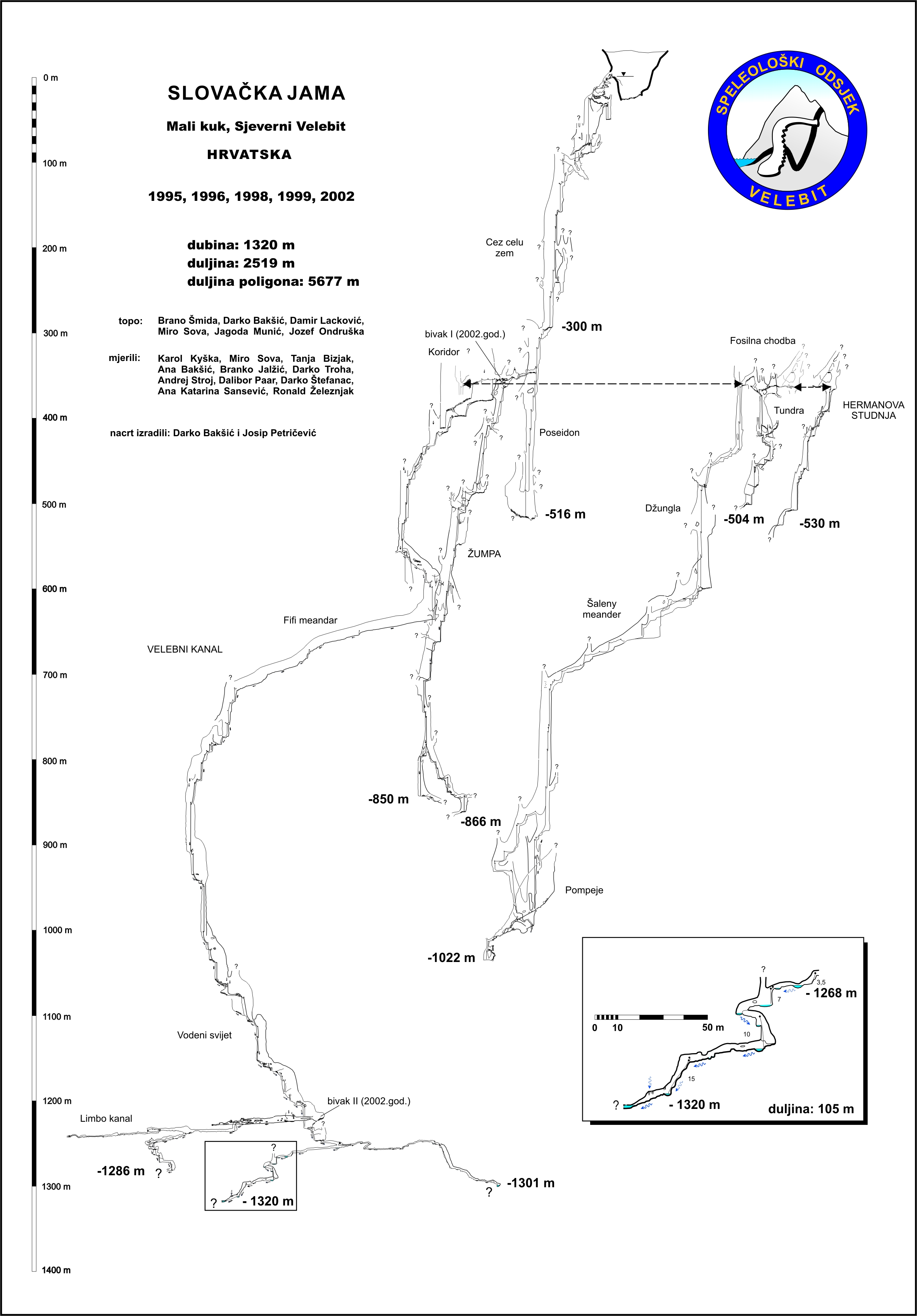
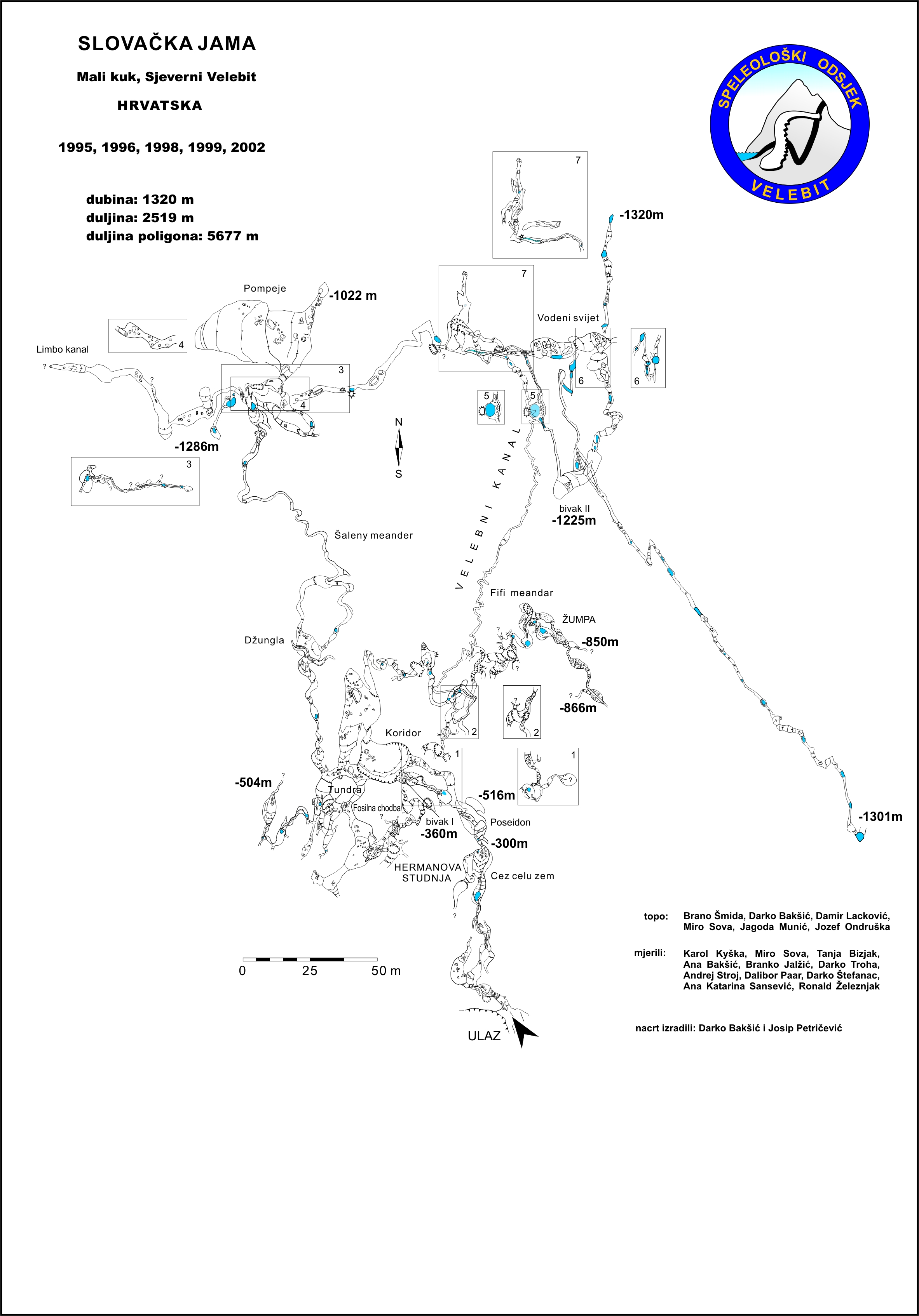
NACRT,
MORFOLOGIJA, GEOLOGIJA, BIOLOGIJA JAME
SLOVAČKA JAMA
Location: Mali kuk, NP Sjeveni Velebit, Croatia
Depth:
-1320 m
Horizontal length: 2519 m
Length: 5677 m
Explored by
(1995.-2002.): SO PDS Velebit, SO
HPD Dubovac,
SO HPD Željezničar, SO HPD Mosor, SO HPD Japetić,
and Slovak speleologists
Topo:
Brano Šmida, Darko Bakšić,
Damir Lacković,Miro Sova, Jagoda Munić,
Jozef Ondruška
Measured by:
Karol Kyška, Miro Sova, Tanja Bizjak,
Ana Bakšić, Branko Jalžić, Darko Troha,
Andrej Stroj, Dalibor Paar, Darko Štefanac,
Ana Katarina Sansević, Ronald Železnjak
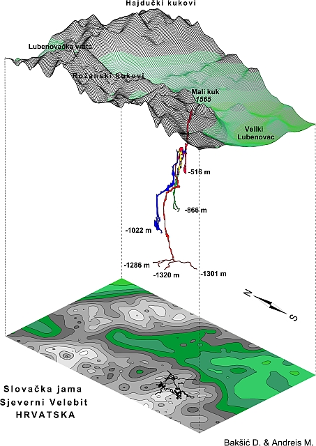
3D view of Slovačka jama by
D.Bakšić and M. Andreis.
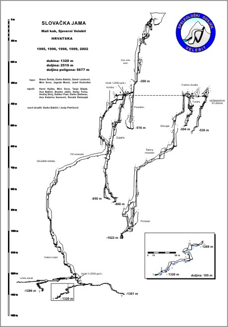
Profile of Slovačka jama.
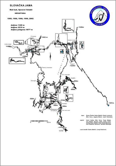
Plan of Slovačka jama.
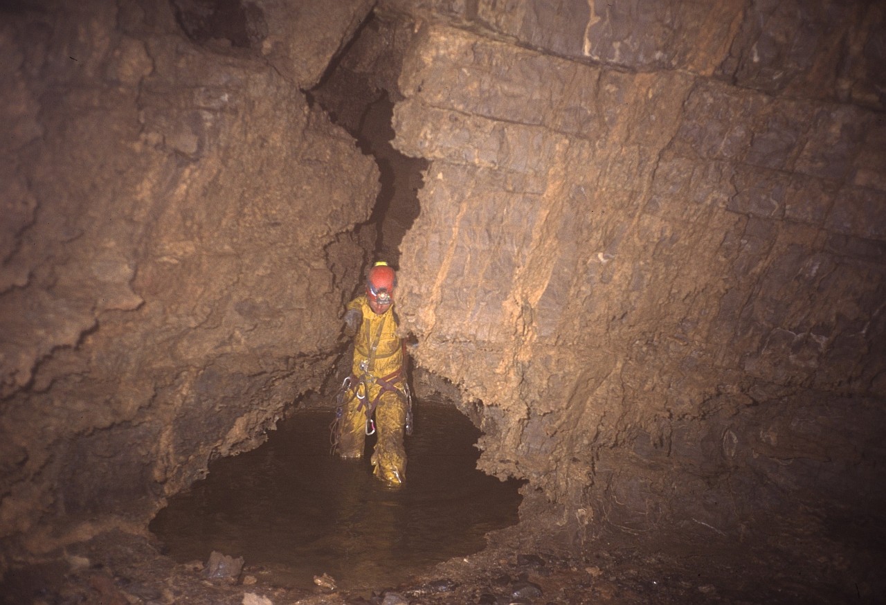
Entrance into
Slovačku jamu is located at 1520 m (5000 feet) above-sea on the
north-eastern part of the great karst sinkhole behind 1565 m
elevation of Mali kuk in the direction of north-west. The climb
lasts for 45 minutes.
Entrance to Slovačka jama. Photo: D. Paar and D. Bakšić
Morphology
Šmida (1996,
1997, 1998, 1999), Bakšić (1997, 1998, 1999), Bakšić and other
(1999) provide description of Slovačka jama
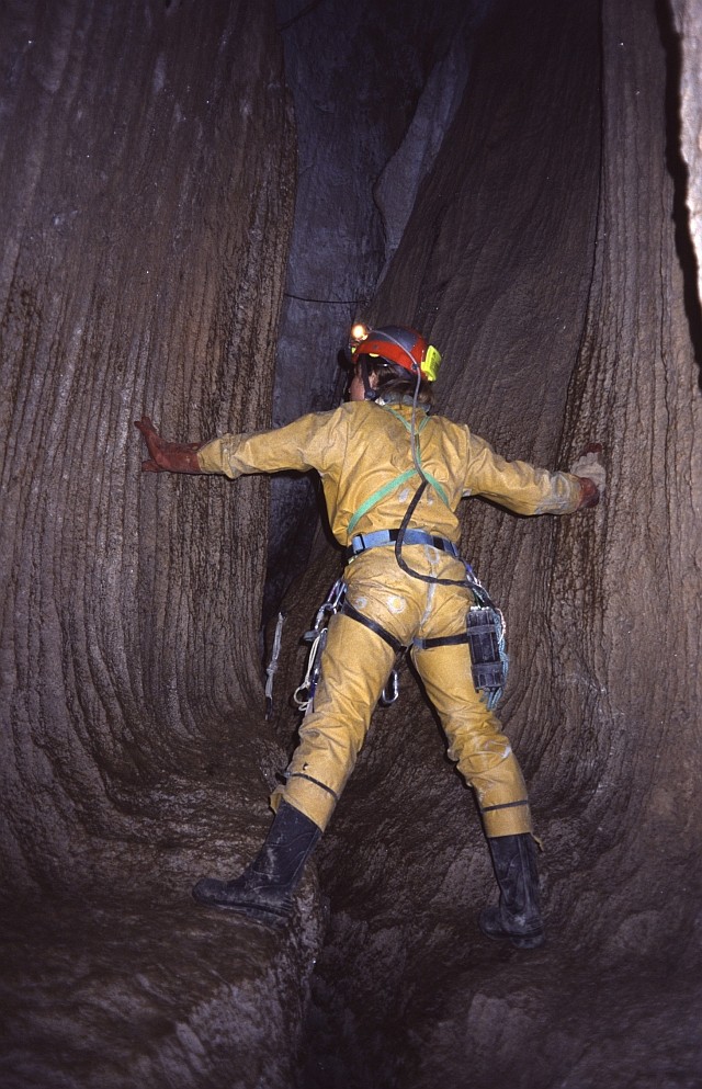
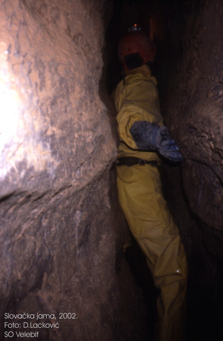
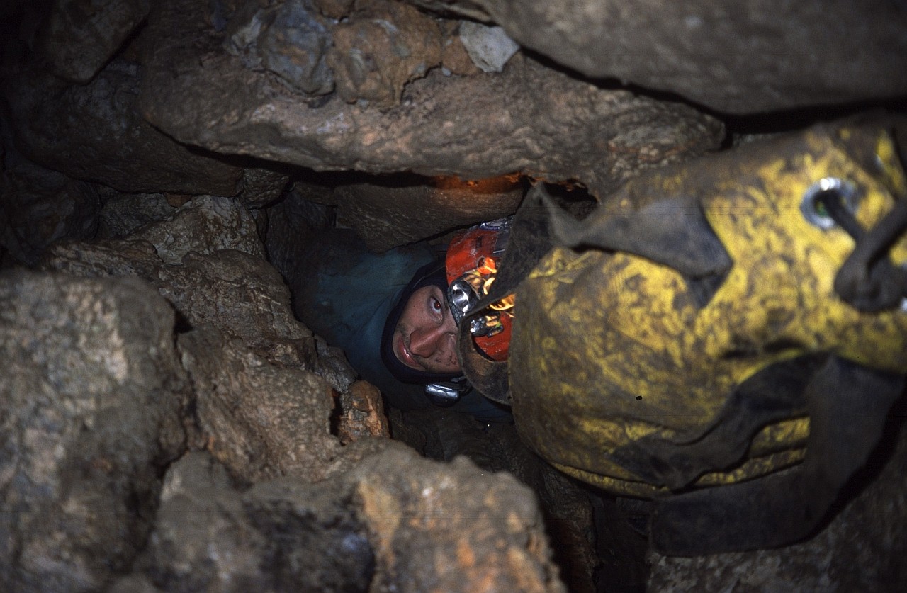
Slovačka jama has a cave like entrance facing south. Entrance hall
with a large stone blocks is named “Horal”. In the hall there is a
narrowing which can be reached via two small jumps (4 and 3 m). The
entrance in the first vertical drop (14 m) is through the narrowing
called “Fučak”, where a strong circulation of air is noticeable. A
small caved passage splits from it in the direction of south-east.
Entrance of the vertical drop “Pokojna” (50 m) is in the opposite
direction through a narrow crack. Before entering this vertical it
is there is a parallel vertical drop to be found under the stone
blocks ending after 26 m and is connected with the vertical
“Pokojna” - thus represents an alternative entrance into “Pokojna”.
The vertical drop of “Pokojna” ends with a tilted hall with a
vertical “Grepova” at its end. Chimneys are arising from the
vertical in the direction of south and northward a narrow meander
stretches with two small jumps. After the first jump there is a
passage through which the Slovak cavers climbed back in 1995 and
reached the 24 m deep vertical. Afterwards they arrived in “Hrncovi”
– a tight meander with cascades ending with a narrowing which cannot
be passed.
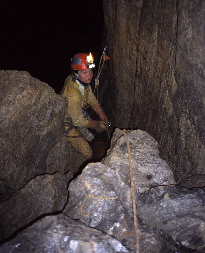
After the long jump through a long crack it is possible to reach the
entering meander where, through a crack on the floor (Učko), the
entrance into 195 m deep vertical drop “Cez celu zem” is situated.
The drop is cut at its upper part with a shelf containing a muddy
pond (60 m). At approximately half a length of the vertical drop
“Cez celu zem” there is an opening leading to a parallel vertical
(Kam?), ending with a meander which cannot be passed. The width of
this vertical is between 3 and 6 m, and the length is in some places
up to 20 m.

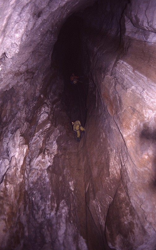
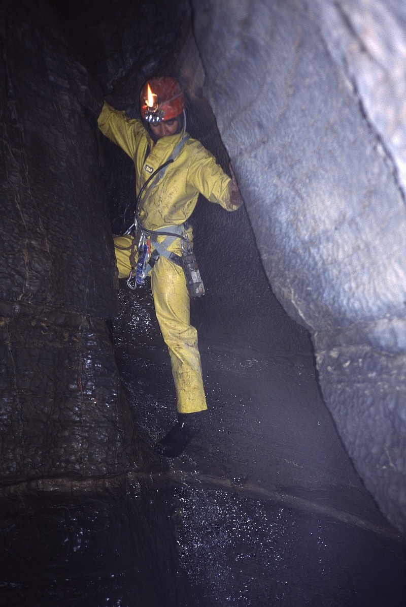
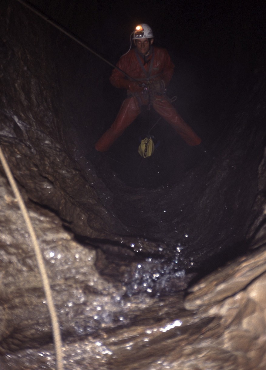
Photo: D. Bakšić
The vertical
“Cez celu zem” ends with a hall 300 m deep, from there across a
short narrowing named “Eriksan” it joins with the following vertical
“Poseidon” (213 m). The vertical “Poseidon” ends with a hall 14 x 6
m large and 30 m high. Up till this part the pit is 516 m deep,
while its horizontal projection in the direction of south is over 70
m long.
In the upper third of the vertical “Poseidon”, at the depth of 349
m, there is an entrance to a horizontal channel - a new part of the
pit. The horizontal channel, whose bottom is covered with stone
blocks and layers of red clay, is starching in the direction of
northwest. After 15 m there is a narrow passage in which the strong
flow of air is present. Behind the passage the channel splits into
two parallel arms which are later joined in the place named
“Koridor”. The north arm, filled with layers of clay, separates its
self before the 4 m jump and contains a large number of bat bones.
Other arm transversely descends after the jump up to -360 m, where,
back in 1998, the first Slovak bivouac was situated, behind the
blocks of stone. The pit is at this point extremely indented and the
two most promising parts are “Črevo” and “Kankulovska vetva” which
continue into “Velebni channel”.
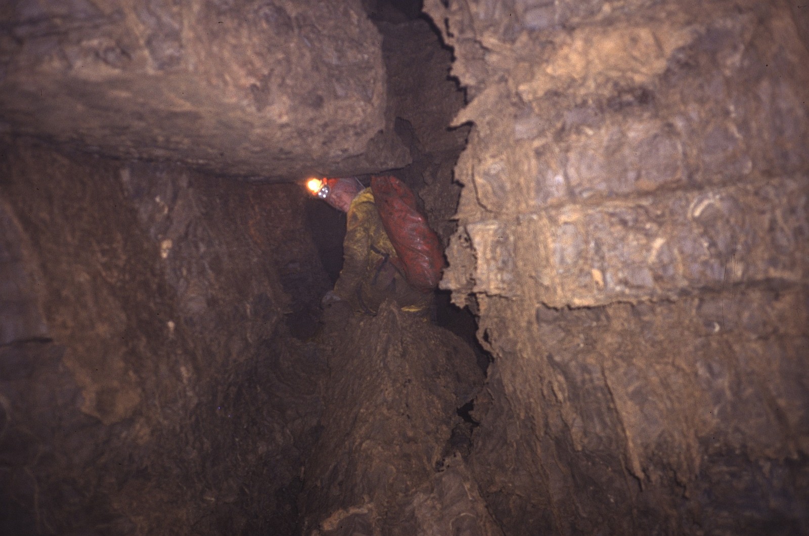
Entrance to a horizontal channel at -349 m.
Photo: Darko Troha
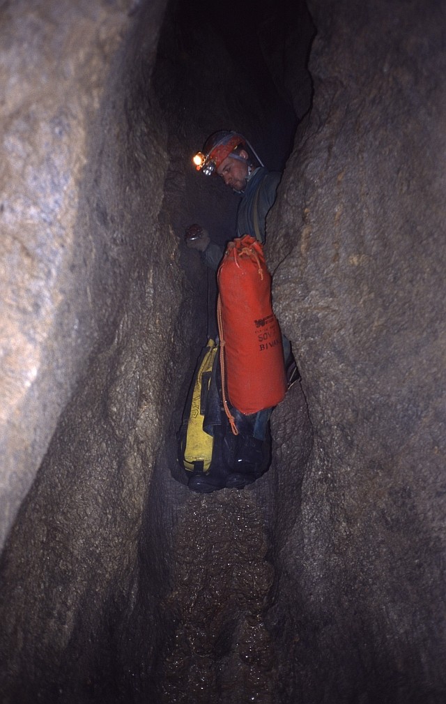
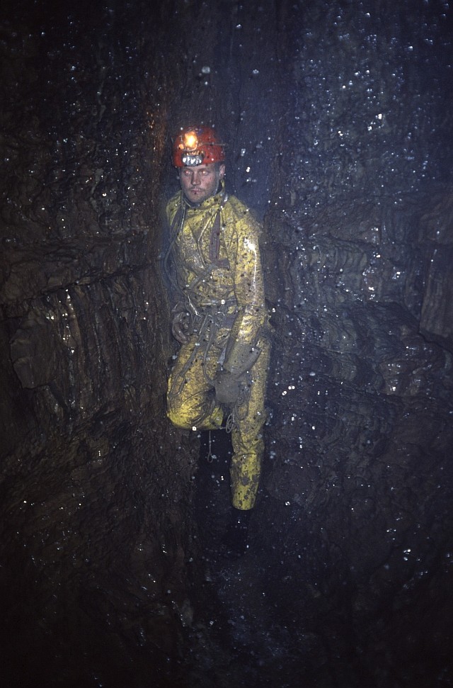
Just before
the Slovak bivouac on -360 m, there is a crack on the floor through
which it is possible to enter a channel named “Žumpa” that runs
parallel with “Velebni channel”. Descending through the verticals of
43 m, 3.5 m of 67 m one can arrive to the narrower part on -490m,
called “Užina Pionierska Odysea”. Next is the vertical of some 24 m,
where a spacious vertical appears from a narrow meander. The
vertical is named “Adriana”, 156 m long. At its bottom, at the depth
of 665 m, in the only possible spot on the very moist shelf the
Slovak carvers’ bivouac was situated. After the bivouac, verticals
of 45 m, 37.5 m and 50 m continue where at the depth of 786 m the
channel splits into two arms: the dry one containing verticals of 19
m, 15 m and 17.5 m ending with a narrowing on -866 m, and the wet
one, descending with a vertical of 46 m up to -850 m, where it also
ends with a narrowing.
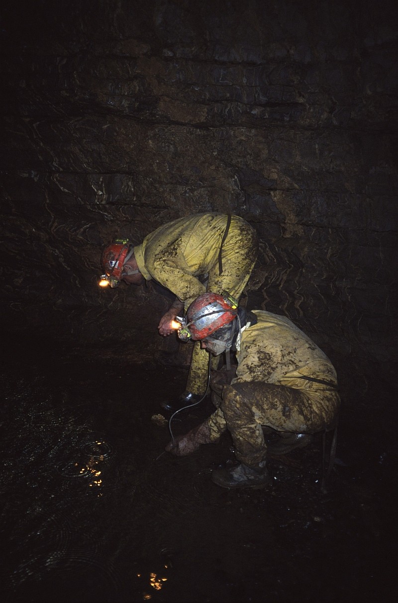
Photo: Ana Bakšić
Behind the
Slovak bivouac (-360 m), the horizontal channel is ended with a hall
(starting point of “Koridora”). The hall is 10 m long and it is
necessary to pass it via traverse in order to reach the continuation
of the horizontal channel called “Fosilna Chodba”. After the
traverse it is necessary to turn left, i.e. direction south by the
channel from which various branches are extending for “Hermanova
studnja”, “Cyklop” and “Tundra”. “Fosilna Chodba” is in fact a
circular channel from which verticals are extended from all
directions.
“Hermanova studnja”, with it verticals of 30, 18, 53, 47, 6 and 12
m, end with a narrowing at the depth of 530 m.
Fourth arm of the pit which exceeds the depth of 500 m is named
“Tundra”. The one on -504 m ends with a narrowing which needs to be
expanded. It is comprised of three larger verticals. First is called
“Tundra” (52 m), on it, after a several small jumps (3 and 6 m) the
vertical “Savana” (17 m) continues. Further on, via an extremely
narrow and jointed meander, there is the last and a bit more
spacious vertical “Tajga” (45 m). In “Fosilna Chodba”, from the
northern side, after 10 m of depth, there is a jump which connects
to “Koridor” and after 17 m there is a starting vertical of the part
of the pit called “Črevo”. The entering vertical is 54 m deep and
after there are shorter jumps (10, 6, 6, 7, 4, 3, 2, 5 and 25 m)
till the entrance to the vertical “Džungla” 100 m deep. The entrance
into this vertical is very narrow. After the narrowing the channel
expands at some parts up to 15 m. It has the oval shape containing a
considerable water reservoir. At the bottom of the reservoir, at the
depth of 598 m, there is a hall, 10 m in diameter with two entrances
into meanders. In the north-eastern part of the hall there is an
entrance into meander “Šaleny” and in north-western part into
meander “Motorola”.
All these
meanders come together on approximately 650 m of depth. Meander
“Šaleny” descends sidelong with smaller cascades and jumps (6, 3, 6,
5, 2, 1, 5, 14, 13, 5, 10, 16, 18 m) till 700 m of depth. Inside the
meander it is sometimes not possible to see the sealing and the roof
because it is transitory only in its central part. Frequent
narrowings (from 20 to 40 cm) and walls covered with layers of clay
make it extremely demanding particularly when transporting the
equipment. Because of the safety reasons and better orientation, the
rope was set through the whole length of the meander. “Šaleny”
meander ends at the entrance in 170 m deep vertical “Patkov skok”.
This vertical is at some places from 15 to 20 m, ending with a shelf
containing a pond (-873 m). The channel runs further, meander like,
till it reaches the next vertical (63 m). The last vertical is 42 m
deep. This part of the pit ends with a large transversal hall
“Pompeii” and the dimensions are 50 x 24 m. At this spot, the second
Slovak bivouac was situated in 1998. At the lowest part of the hall,
there is a narrow passage into “Garlik” which runs below the hall
“Pompeii” and ends at the depth of 1022 m. From the last bolt in the
vertical “Patkov skok” at the depth of 843 m it is possible to cross
via transverse to the opening on the east side of the channel.
Across the series of cascades and shorter jumps (9, 30, 10, 15, 50,
8 and 10 m), the channel called “Bituminozna šachta”, at the depth
of 985 m, rejoins again with hall “Pompeji”.
Photo: D. Bakšić
In the other
main arm of the pit, below the shortcut which connects the Slovak
bivouac (-360 m) with “Fosilna chodba”, Koridor opens up – the space
containing three halls in a sequence are joined with a smaller jumps
(16, 10, 14 m). In the first hall on the depth of 376 m the first
Croatian bivouac was situated in 1998. Other hall is the biggest one
and it rises tilted towards south where a jump connects it to
“Fosilna chodba”. The third and the smallest hall ends with a small
chasm. Floors of these halls are covered with debris and stone
blocks and the sealing, due to its height, cannot be seen. From the
third hall via a traverse line across the chasm and 15 m high jump
there is an entrance into a meander-shaped narrow channel which
descends through the cascades for another 10 m till it reaches the
narrowing “Vločki”, 438 m deep. This is most unpleasant narrowing in
the pit. After the narrowing and several smaller jumps (11, 2, 2, 6
and 9 m) the channel ends in a small hall from which a new narrowing
enters into 91 m deep “Daždova studnja”. It is possible to avoid the
narrowing by climbing from the upper side. “Daždova studnja” is cut
at approximately half of its length by a 2 m long shelf. At the
bottom of the vertical there is “Pijavični meander”. The place was
reached by Slovak cavers in 1996. From this place till the end of
the pit “Velebni channel” follows. At the very beginning of the
meander in its northern arm, sidelong towards up, there is a small
shelf 2.5 x 2 m, where back in 1998 at the depth of 557 m another
Croatian bivouac was situated. Meander, in which the ceiling cannot
be seen, or where instead of the ceiling there are wedged stone
blocks, drops diagonally with series of cascades and jumps (2,5, 6,
15 m) till it reaches 4 m long shelf with the water cascades. Next,
there is a 43 m long vertical leading up to the entrance into “Fifi”
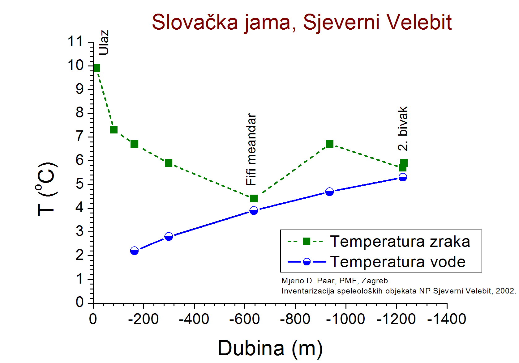
meander. Narrow and rugged 235 m long “Fifi” meander is starched
from 636 till 717 m of depth. That depth is similar to the depth of
“Šaleni” meander.

Fifi meander. Photo: D. Lacković, D. Bakšić
As opposed to
the “Šaleni” meander, “Fifi” meander at its bottom can be completely
walked through and the ceiling cannot be seen through the whole
length of the meander. The rope is required only in two places (2
and 8 m). After the meander there is a vertical of 57 m with two
smaller shelves. At the bottom of the vertical there is a small hall
after which there is a jump of 7 m leading to the passage “Prolaz
pješčanog sata”. From here through a narrow meander, new 7 m jump is
reached and further on, through a couple of jumps (8 and 21 m) and
small shelves, there is a small hall “Rifljača”. From it, there is
an entrance in 124 m deep vertical whose central part contains
60-meter overhanging rain protrusion with the channel diameter up to
10 m. The very bottom the vertical contains several short shelves.
On this vertical, till the first bigger shelf, the 92 m vertical
continues. Behind it there is another smaller one (17 m). At the
depth of 1060 m the place expands into two halls mutually connected
with 13-meter jump. The first one, because of the large cistern, it
is called “Kišna” (Rainy) and it is covered with stone blocks among
which a small pound is situated. The other one is covered with
detritus and contains several larger stone blocks at the entrance to
the next vertical. From here till the its bottom “Vodeni svijet”
extends as a whole and with the series of verticals (28, 48, 5, 3,
23, 27 i 13 m), cascades and ponds reaches the depth of 1249 m. From
it through the passage in the floor there is an entrance to a
channel washed with a watercourse which after 18 m and at the depth
of 1254 m expands into a hall named “Dvorana dubokih siga”. From
“Dvorana dubokih siga” there are two channels: near the dripstones
the channel continues in the direction of southeast and just before
the dripstones the channel continues, by the passage in the floor,
in the direction of north. The channel towards the northeast slowly
ascends and after 30 m it abruptly turns towards north and starts to
descend with a 3 m slope. At bottom of the slope it turns, again,
towards northeast and retains this direction till the end. It is
possible to continue onwards with a horizontal part of the channel,
45 m in length after which the channel ascends knee-like and then
drops till it reaches the 28-meter jump. After the jump in the
narrow meander there is a siphon at the depth of 1301 m which can be
reached through a narrow meander. The average width is approximately
between 1 and 2 m. The channel with a water course continues, with a
passage in the floor, in the hall “Dvorana dubokih siga” and
descends to the pond situated at the depth of 1268 m.
Exploring the channel towards a siphon at -1320 m.
Photo:
D.Bakšić
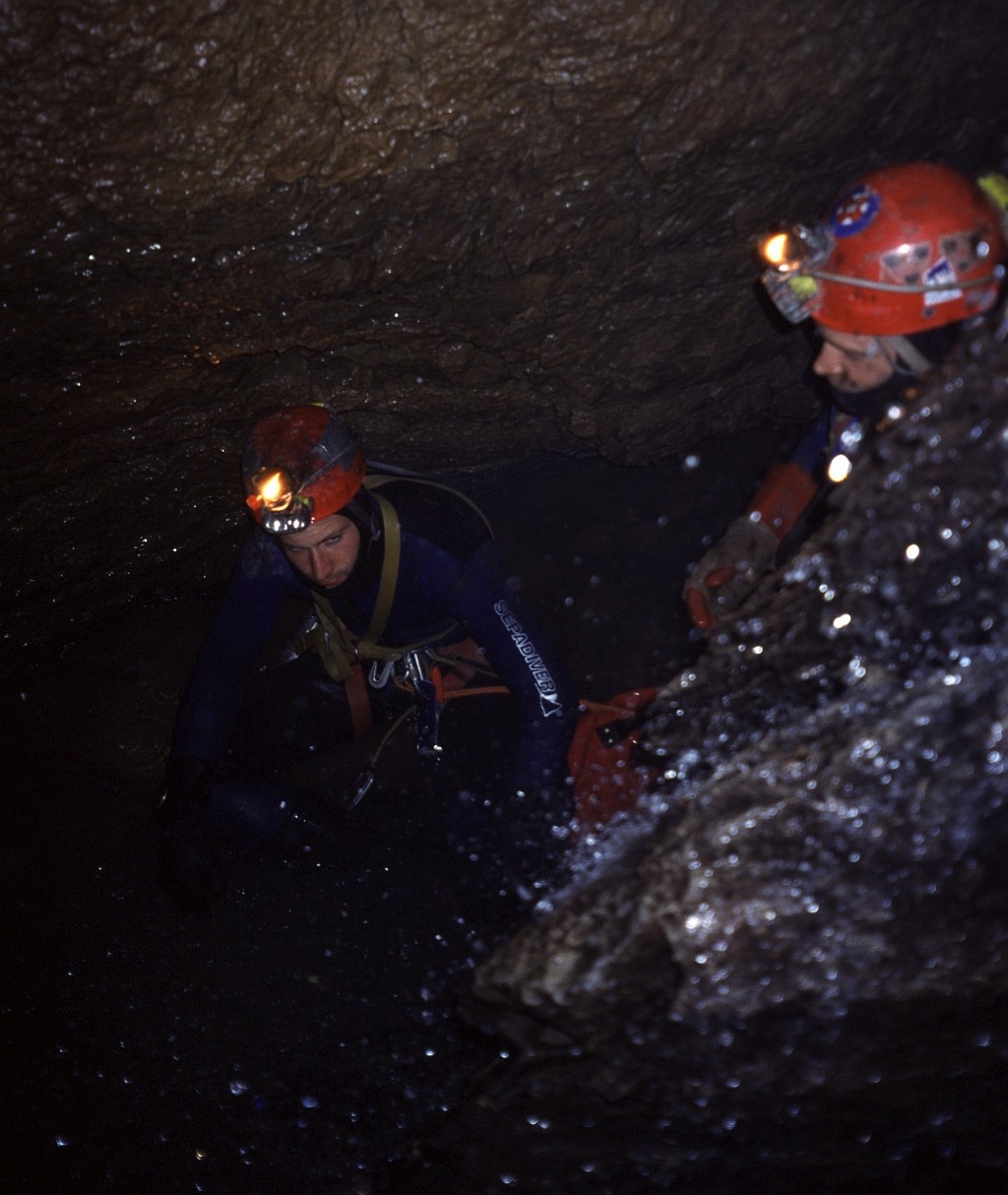
After the pond
where the ceiling descends at 25 cm from the surface of water the
washed out channel curves in the shape of the letter "Z" and turns
towards north. Through 3.5, 7 and 10 m, and 18 m jumps and the long
slope the -1320 m (12530 feet) siphon can be reached which is at the
moment the deepest examined area in the pit. The siphon itself can
be examined by diving but because of the small space, narrow channel
and large depth this would be an extremely demanding feat. Apart
from the siphon, other dripstones have been found which represents
the deepest finding of dripstone formations in Croatia. Considering
that water passes through the whole channel, small ponds are formed
below the verticals, and the stone wall of the channel is washed
out. The width of the channel is approximately from 0.5 up to 2 m
while its height if from 0.5 to 3.5 m.

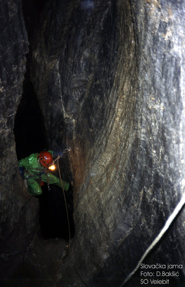
Hrskavi channel. Photo: Dalibor Paar
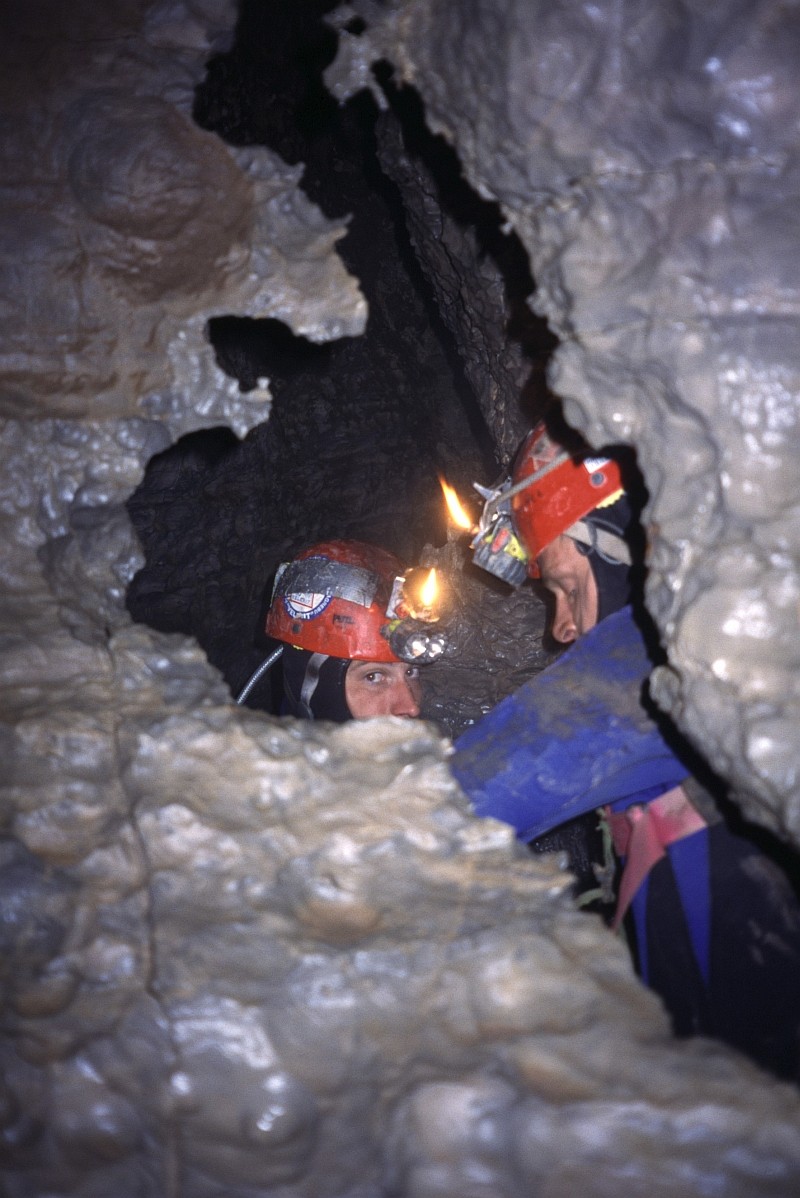
In the
southwest part of the hall, at 1225 m of depth, there is an entrance
to the channel coated with clay. The entrance part of this unit is
“Hrskavi channel” which in general extends to the north at its
beginning and afterwards turns in the direction of west. “Hrskavi
channel” is connected to “Limbo channel” with a narrowing, after
which, there is a shelf and a jump 8 m high for which the use of
rope is needed (descending by “Frenchman”).

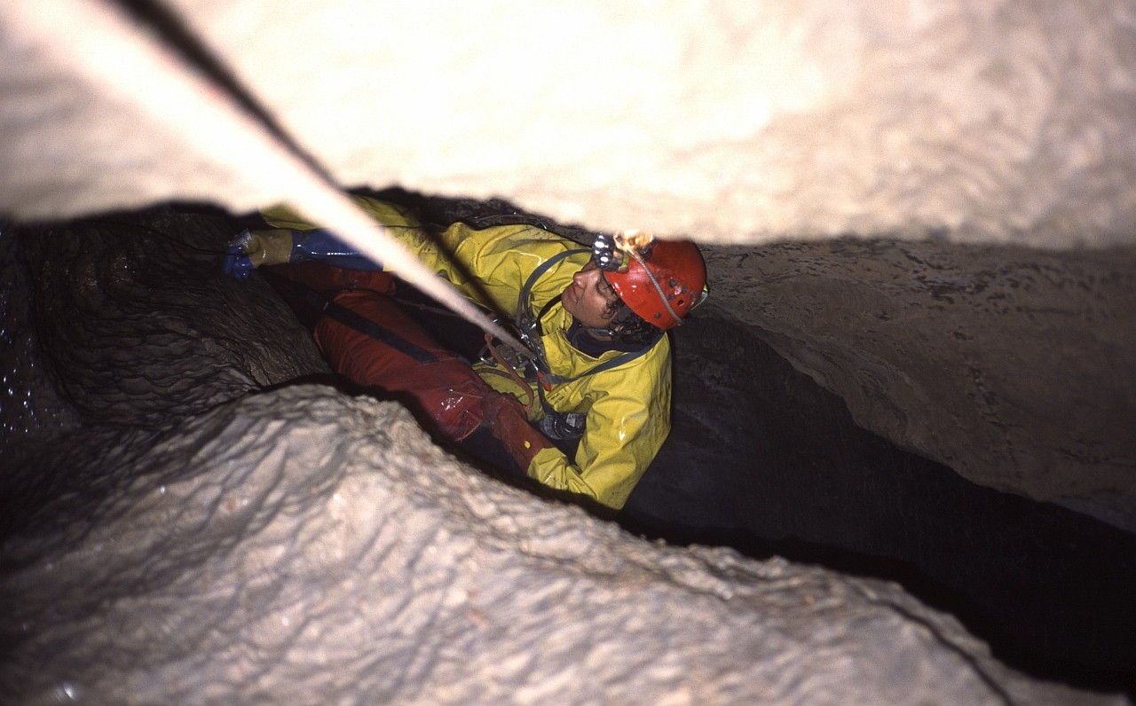
Passage to Limbo channel. Photo: Ana
Bakšić
“Limbo
channel” is 3 to 5 meters wide, at some places even 7 m and after
the rather narrow “Hrskavi channel” leaves an impression of
spaciousness. It ends with a lowered ceiling, i.e., caved stone
blocks through which one could crawl through but because of very
small size of the passages crawling can be dangerous. The flow of
air is felt between the blocks indicating the existence of space
behind it. Following the week flow of the water 60 m after the
stated 8-meter jump through the crack in the floor from the channel
“Limbo” there is an entrance to “Meandar Oštrica”. At the beginning
this is a narrow and muddy meander with sharp rocks after which four
jumps (10, 7, 7 and 9.5 m) follow. Behind it, there is a short
meander ending with a turn and unpassable narrowing at the depth of
1286 m.

Photo:
D.Bakšić
Passage to meander Oštrica.
Photo: Dalibor Paar
Rainy doors. Photo: Ivica Ćukušić
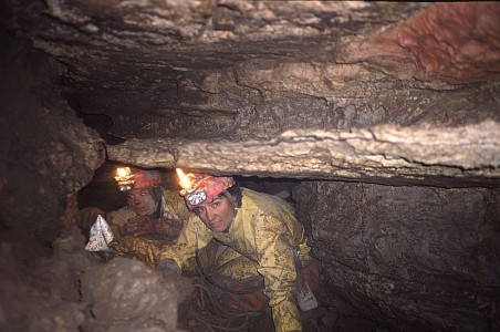
Photo: D. Bakšić

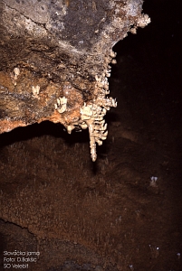
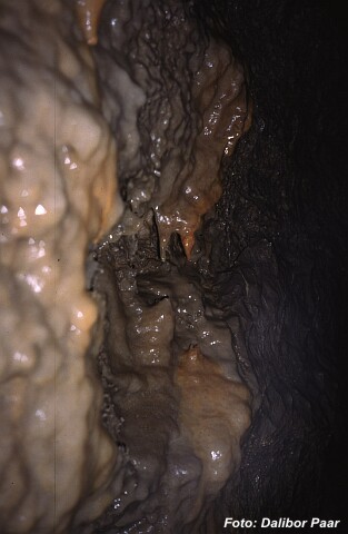
(left) Speleothems in Fifi meander (at -700 m).
Photo: Dalibor Paar
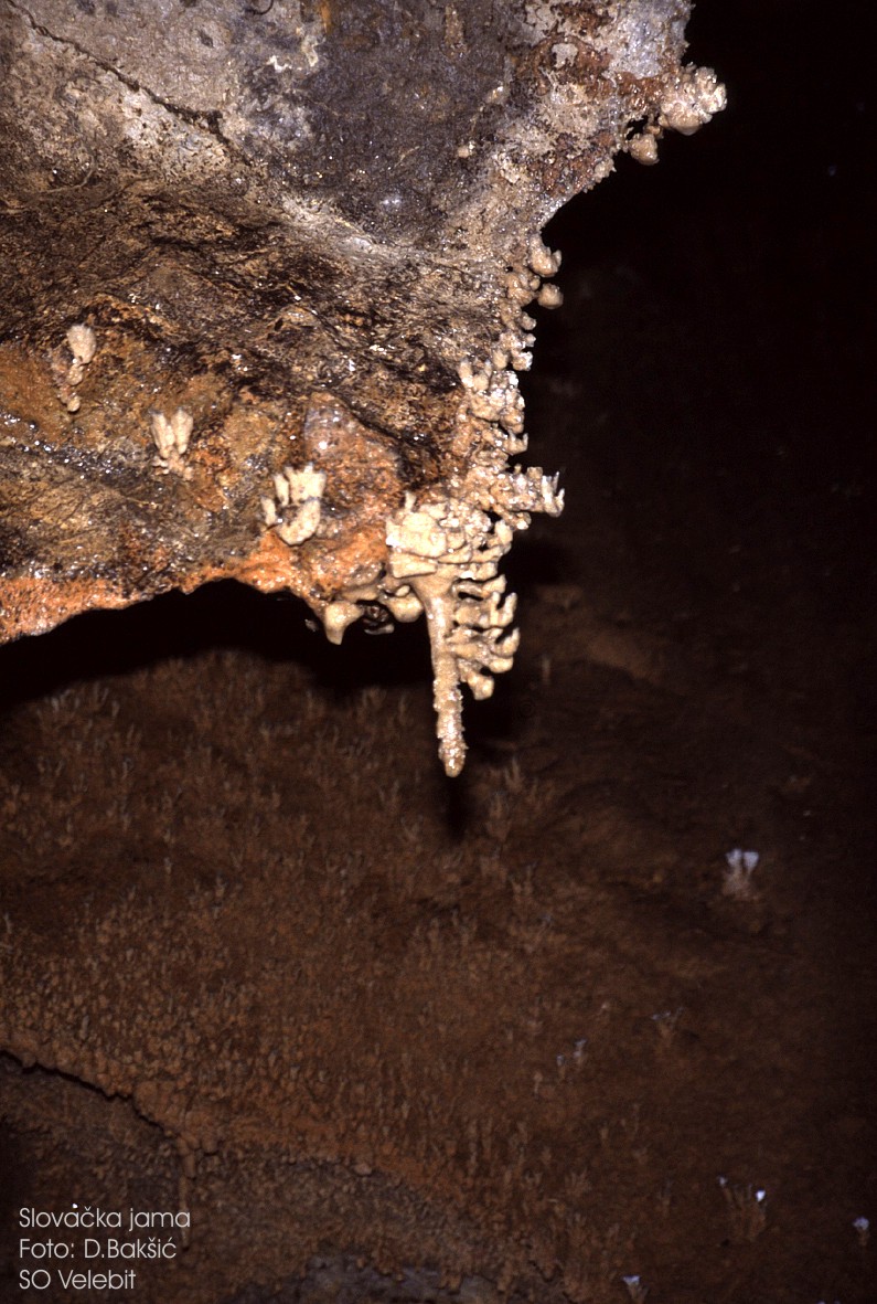
(right) Coralloids. Photo: Darko Bakšić

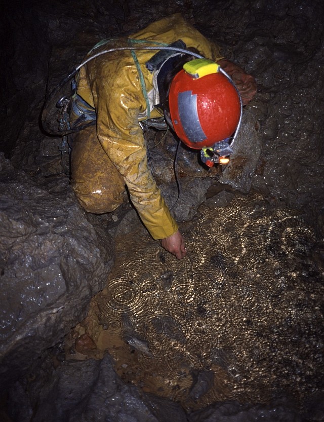
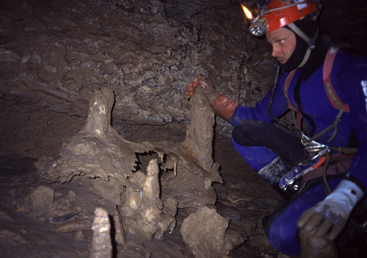
In the Hall of deep speleothems, -1268 m.
Photo: I.Ćukušić

Photo: D.Paar
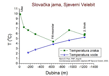
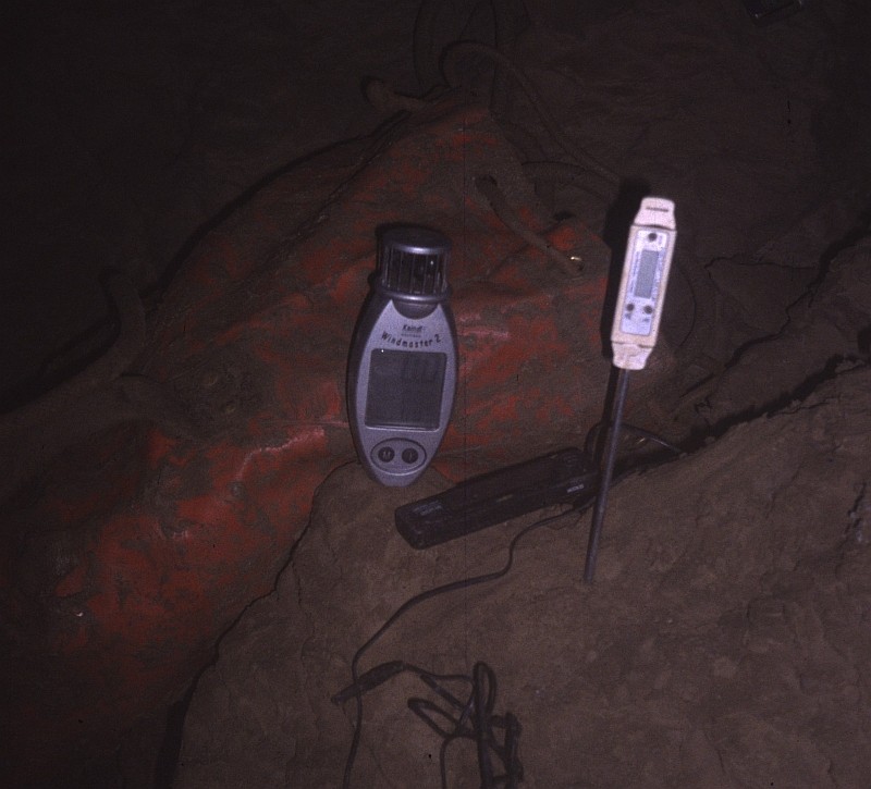
Air and water temperature
measurements in the pit. Measured by D.Paar
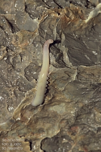
Croatobranchus mestrovi in Slovačka
jama. Photo: B. Jalžić
Croatobranchus mestrovi. Photo:
D.Bakšić
|