|
|


|
|
|
|
SpeleoGoogle |
Velebita - world deepest underground pit
Rožanski kukovi, National park North Velebit, Croatia
|
SpeleoGoogle |
Cave explorers from
Speleological section Velebit with a few other
Croatian clubs discovered
in 2004. a pit inside a mountain Velebit in central
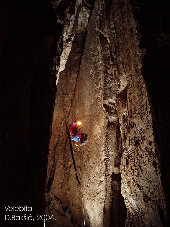
Croatia believed to have the world's deepest subterranean free-fall vertical drop, at nearly
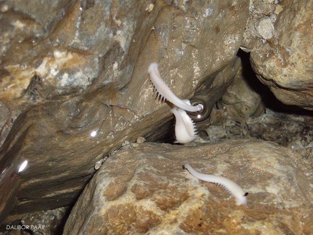
513 m. At the foot of the Velebita cave are small ponds and streams, including one of the
largest known colonies of subterranean leeches. It is located in the Rozanski
kukovi area of the National park North Velebit in the rocky Velebit mountain
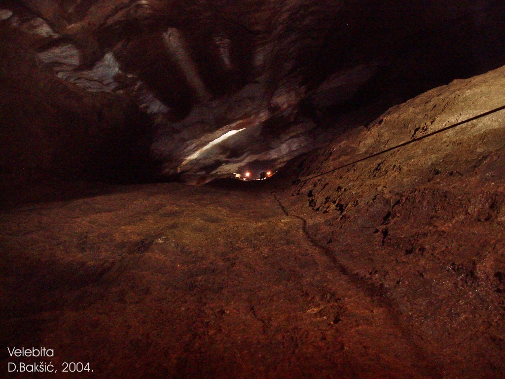
range in central Croatia. Results of expedition Velebita 2004.
Climate: During the expedition
in 2004. the cave microclimatic parameters were monitored and some
additional physical measurements were performed in the cave.
The most important biospeleological find:
Numerous troglobitic species were identified in collected material.
Among them the most important are small snails from the genus Zospeum,
terrestrial isopods from the genera Titanethes, Alpioniscus and
Androniscus, millipedes from the genus Haasia, pseudoscorpiones from the
genus Neobisium and numerous springtails and beetles from the genera
Astagobius and Spelaeodromus. The largest colony of endemic troglobitic
leech Croatobranchus mestrovi so far was found in the Velebita Pit, and
one and only specimen of the troglobitic harvestman, probably from the
genus Hadzinia (Bedek & Ozimec, 2004).
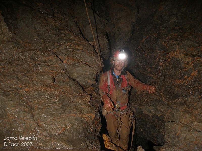
Cave exploration continued in 2005. and 2007. The result of the exploration is a new cave depth -1026 m. The second entrance was found. The Velebita cave system is the third pit deeper than 1000 m in the National park North Velebit (Croatia). During the expeditions, physical and chemical measurements were performed in the pit (water analysis, measurement of microclimate parameters, natural radioactivity measurements). The cave exploration and scientific research is supported by National park North Velebit - project of speleological and biospeleological explorations of the park, The Speleological Committee of the Croatian Mountaineering Association, Croatian waters, and private donators.
Literature:
PDF
Physical and Chemical
Research in Velebita pit (Croatia)
Bakšić, D., Paar, D.,
2006: Croatia and the Deep Caves of Northern Velebit. Alpine Karst, vol
2., ed. J. & T. Oliphant, 105-124, Cave books, Dayton, USA.
More about the
exploration of deep caves in Croatia and contact info Text: Darko Bakšić, Ana Bakšić and Dalibor Paar |
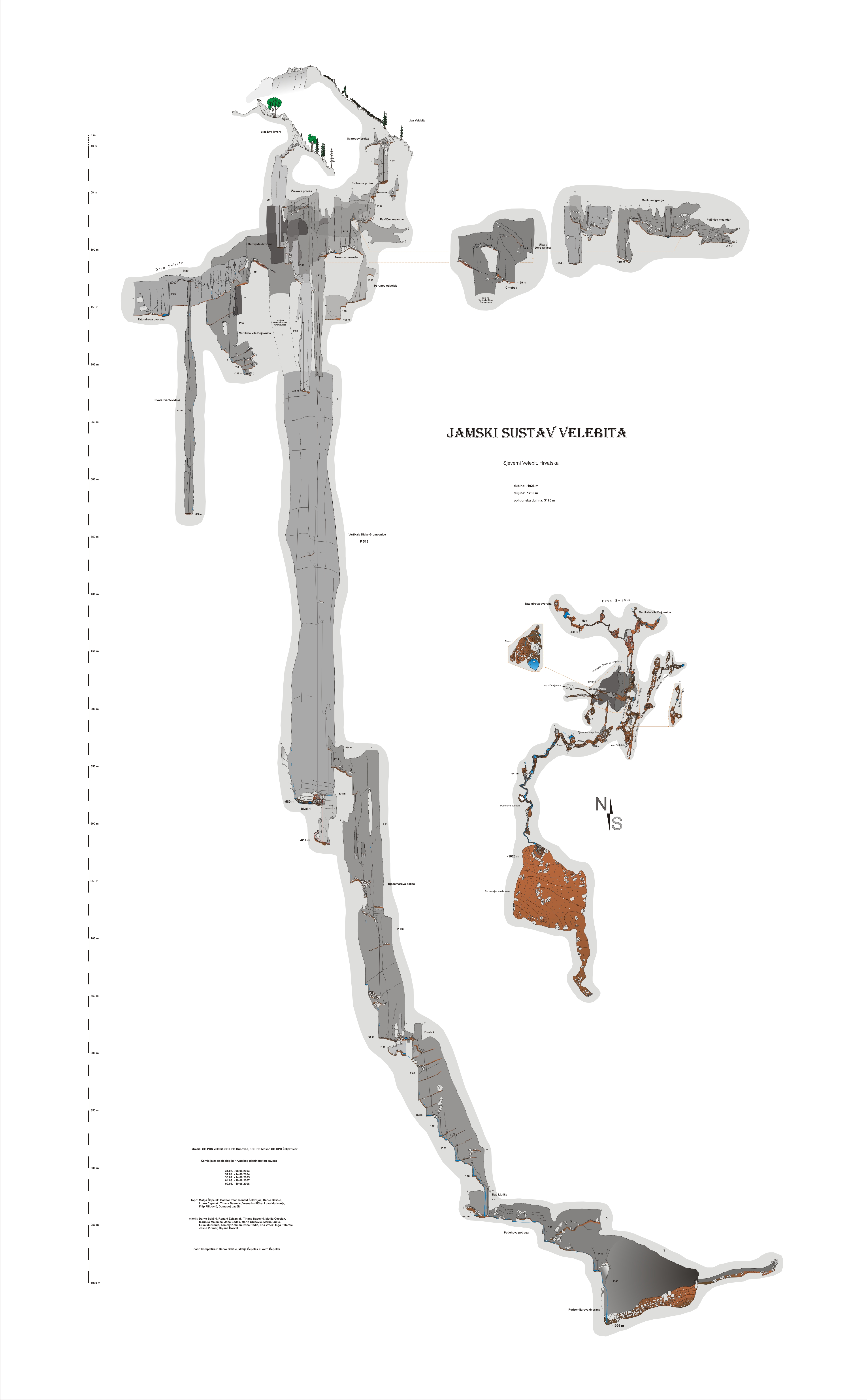
VELEBITA TOPO AND MORPHOLOGY Name: Cave system Velebita Location: Rožanski Kukovi – Crikvena, National park North Velebit, Croatia Entrance at altitude: 1,557 m Depth: -1026 m
Horizontal length: 1206 m Cave discovered by: Speleologists from the Speleological section of the University Mountaineering Association "Velebit" (SOV) on 31 July 2003.
Period of exploration: 2003, 2004, 2005, 2007., 2008.
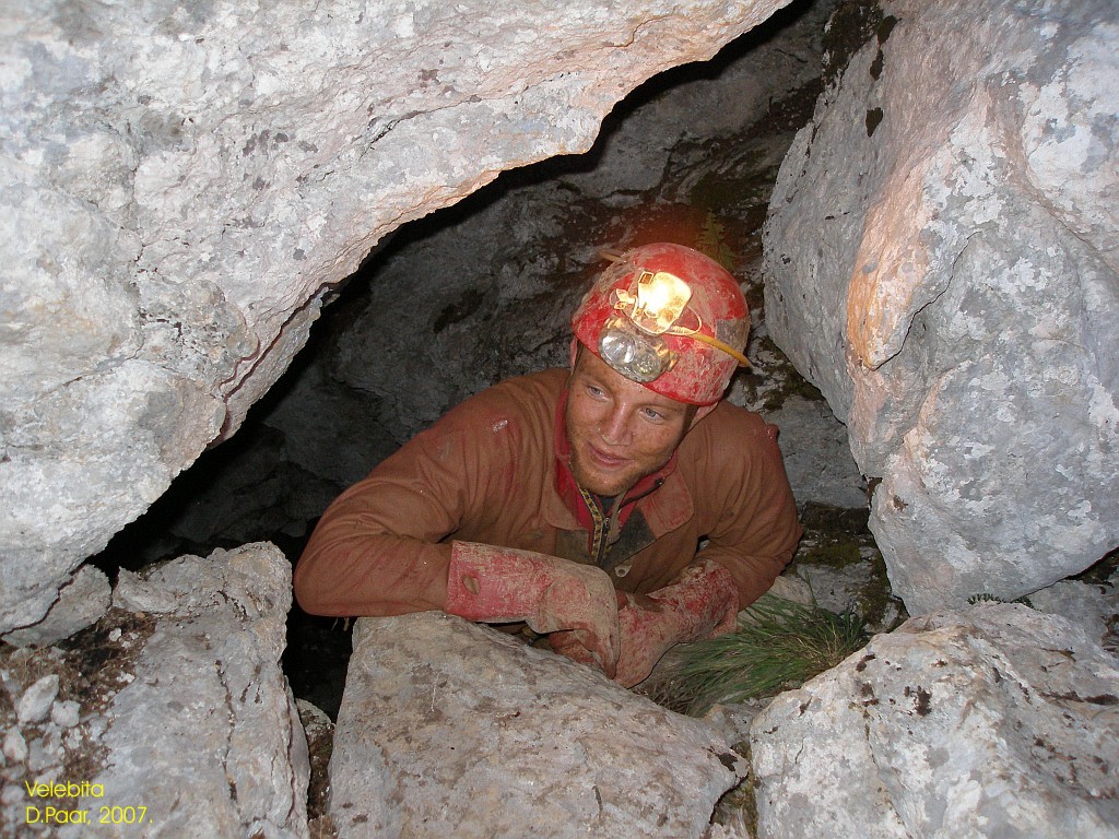
Morphology: The entrance to Velebita Cave descends freely between lodged boulders to the entrance chamber, which is well lit by daylight. Between the boulders and the compact rock on the floor there is the Svarog Passage, which leads to an over-hanging shaft of 28 m. The bottom of the shaft is 8 x 4 m in size. It is situated at a depth of –40.6 m and is covered with chock.
In 2005. we placed the ropes in a different way and
managed to enter to the meander 40 m above the old bottom, thus avoiding
150 overhanging wall at the bottom of Divka Gromovnica shaft. We entered
to the meander by traversing the sloping ledge followed by 13 m drop.
Through meander with clay covered bottom one walks in direction south
for 15 meters passing another smaller drop of 5 m. Meander leads to the
entrance to the shaft stretching in direction NE-SW, and the shaft ends
after 93 meters on the ledge covered with stone blocks (Bjesomar’s
ledge). Bjesomar’s ledge closes In NE direction, but it continues in
SW-W direction. One descends for 138 m, passing 4 smaller ledges created
by lodging of stone boulders in vertical meander, to the next larger
ledge (on the depth of -785 m) where it is possible to walk freely. In
the center of pebble covered ledge is a huge stone block. Below it is a
passage where one walks near 10 m high drop. This 10 m high drop is
actually shaft connecting to the main channel from the north side. After
30 m of length the ledge has a knee shape turning first in direction NW,
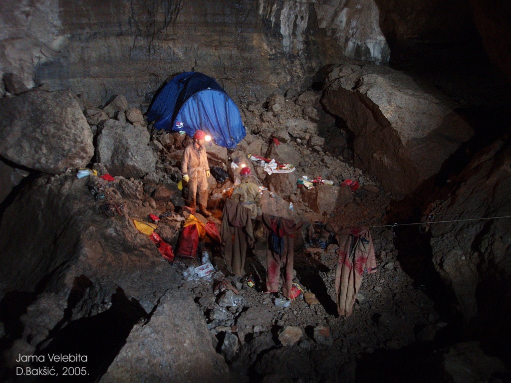
and then sharply in SW direction. This ledge could be used as a place
for bivouac for next expeditions. The pit narrows from this point on,
and through vertical drops continues through the meander in SW
direction. Here also starts the permanent water flow continuing till the
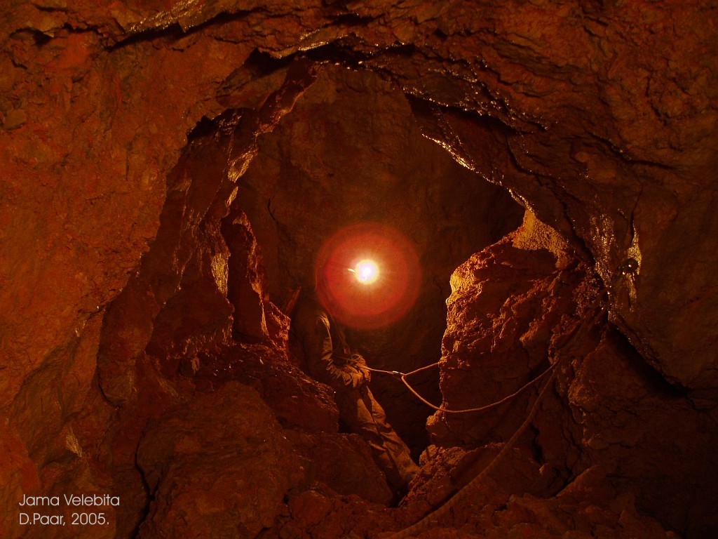
present bottom of the pit. The first drop is 65 m high and ends at the
ledge with drip-water. On this ledge we widened, by moving the stone
blocks, the passage through the meander leading further in deepness
(precaution should be taken due to the possibility of collapsing
stones). One reaches the bottom on the depth of -941 m (in 2005.) by
passing shafts of 19, 25, 18 i 27 m. The rope is placed to maximally
avoid the water, but in two last shafts one descends through strong
drip-water. It should be mentioned that the weather condition in august
2005 caused higher water level in the pit. The present bottom of the pit
is a chamber named The quest of Potjeh. In the north part of the chamber
there is a narrow meander with new water flow joining the existing flow
that lessens in narrow meander in south part of the chamber. Both
meanders are narrow and should be enlarged in order to pass further.
The entrance to Dva Javora (Two Maples) Cave is 66 m northwest from the entrance to Velebita Cave. The Cave of Dva Javora also has a cave entrance 7.3 m below the entrance of Velebita Cave. The entrance is a vertical crack of 5 x 0.5 m. The cave has a cascading shape and descends to a depth of –12 m in three short pitches of 2 m, 3 m and 3.5 m. The entry part is the narrowest point between 0.3 and 0.5 m wide and between 5 and 3 m high. At a depth of 12 m there is a tight passage to a vertical meander, followed by a shaft of 70 m to Bear Chamber. At a depth of – 62 m (at – 55 m from the entrance to Dva Javora Cave), to the west, there is a traverse through the meander (named Žrek's traverse) to the highest point of Divka Gromovnica shaft (the total shaft length is 513 m). |


|
CROATIAN SPELEOLOGICAL SERVER CAVES OF CROATIA SCIENCE CAVE PROTECTION |
© 2009. CROATIAN SPEELOLOGICAL SERVER |